Measuring target distance with GPS

jimisbell

Well-Known Member
Joined
Jul 24, 2020
Messages
486
Location
ingleside, TX
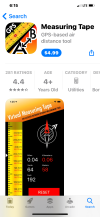
I am setting up a range for up to 4,000 yards. I want to use a simple GPS for measurements. Not sure which ones will work. BUT....I DON'T NEED MAPS!! All I need is the ability to mark both ends of the path and have it calculate the distance. Assuming level ground. Even without the calculator I could use pencil and paper to calculate it if the unit would give me the GPS positions. It seems that most small handheld units are geared to using maps and land marks, not just raw GPS.

But there may be some out of the box solutions as well.
1) is there a program for tracking that will use my phone to find a tagged object and give me the distance to that object?
2) Since my phone does have GPS information that is accessible to the police, how can I access that information?
3) maybe time the bullet from firing line to target? That would be hard without very accurate instruments.
Any other ways other than a 3 mile tape measure?
 
If you want it accurate you would need a sub-meter accurate gps unit that runs real-time corrections. If you want it say 2-3m (8-10')accuracy most of the Garmin handheld units will allow you to mark a location and average gps points until you get decent accuracy.

An iphone or garmin without averaging a location and doing corrections would be lucky to be within 7m (21') at each end, or 40ish' accuracy.
 
Try this. I used it to establish my 1450yd range.
 

Attachments

  • C49BEA50-F9FE-415B-A6CC-0504E6640EFB.png
    C49BEA50-F9FE-415B-A6CC-0504E6640EFB.png
    195.6 KB · Views: 357
What is the procedure to mark the two ends of a line you want to measure?
Hit tools, then line distance, then move the crosshairs where you want them (you can zoom in and out), drop one point, then drop another and it gives you the distance. You can add multiple points. I would play with it and you will figure it out quickly. You can then save the lines if you want.
6A550A5B-3094-4CF2-B814-7BF994DD7852.jpeg
2D6EF7D7-4D5C-4040-965D-F7A3D9AA33D4.jpeg
 
Hit tools, then line distance, then move the crosshairs where you want them (you can zoom in and out), drop one point, then drop another and it gives you the distance. You can add multiple points. I would play with it and you will figure it out quickly. You can then save the lines if you want.View attachment 342388
How easily can you accurately place your cross hairs? That is where I am having my problem. I will be in the field standing at my target position and the satellite view on the map is two years old so it wont show me standing there? I dont know in advance where I will be, I will have to be where the soil allows me to dig post holes. That I can not see from a satellite map that is two years old.
 
Last edited:

Recent Posts

Top