So I was in the army and I'm a big fan of MGRS. But I am now a civilian and also a geology student. The rest of the world uses UTM, as do geologists.
I have familiarized myself with UTM In my geospacial applications class. MGRS is based off of UTM so they are very similar. I want to start actually using it while im out hiking fishing and hunting. With MGRS maps I had reached a point where I could eyeball 10 digit grids to within 10 meters. But with UTM I feel like I need to get out and walk a while and get back to basics for land navigation.
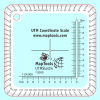
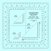
Can anyone recommend a good robust protractor. In the military we call them protractors. I have seen them online called plotters. I would like one with several map scales on it. Geoscientists use maps in just about every scale you can imagine.
Anyone have a favorite? Ive seen a few out there that looked promising but its hard to actually tell on pics.


