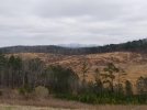
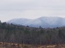
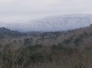
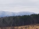
I've mentioned before about the land that was turned into a wildlife Refuge. Well here's some pictures of it after higher altitude snow came through. My house is lower on the left slope in the pictures.
-
If you are being asked to change your password, and unsure how to do it, follow these instructions. Click here
You are using an out of date browser. It may not display this or other websites correctly.
You should upgrade or use an alternative browser.
You should upgrade or use an alternative browser.
Pictures of mini wilderness behind my house
- Thread starter Rosebud
- Start date
 Help Support Long Range Hunting Forum
birddog 68
Well-Known Member
I didn't think it snowed in Alabama! lol
Looks like those mountains have some elevation.
Looks like those mountains have some elevation.
It looks like you are close to the southern end of the Blue Ridge Mountains. Do they allow hunting in the refuge?
Some of the highest in Alabama. No hunting is allowed on the side you see in the pictures. Other side is part of Choccolocco wildlife management area, 58 thousand acres. They have scheduled hunts with firearms. Archery is season long. Some Ibex that excaped from a game farm have wandered in you can archery hunt them been breeding for couple of years.
End of Appalachian Mts.It looks like you are close to the southern end of the Blue Ridge Mountains. Do they allow hunting in the refuge?
tankgijohn72
Well-Known Member
- Joined
- Feb 11, 2014
- Messages
- 464
looks like cheaha
End of Appalachian MtsIt looks like you are close to the southern end of the Blue Ridge Mountains. Do they allow hunting in the refuge?
March 13 th, 1993. Snowed 18 inches in six hours. Birmingham looked like Buffalo NY during A blizzard. Out of powder for eight days. Lost everything in my deep freezer. Three whole deer and other frozen items. Had generator wired into the house after that.I didn't think it snowed in Alabama! lol
Looks like those mountains have some elevation.
Thanks for the pictures, I would say that most if not all members here are inflicted by what the terrain looks like over the next ridge, it's great to see what other country actually looks like instead of what our minds think it does.
Cheaha is about twenty miles south. Highest point in Alabama, beats these Mountains in the pictures by about 100 feet. Look on the right slope you can see a road going up from right to left. Called ten mile road. The right edge is a gap called bains gap and the mountains continue on to the south for about 45 miles. but these are the most rugged. Used to be a military base called Ft. McClellan. Anyone who ever trained there during basic training will remember them. But not fondly!looks like cheaha
pretty FOOThills they are 
That they are, one time they were taller than the Rocky mtn. Now worn down to a nub. Its like the riddle from the book the hobbit. This thing all things devours, birds , beasts trees and flowers. Gnaws iron bites steel, grinds hard Stone to mill. Slays kings, kills men , brings tall mountains down. What is it.pretty FOOThills they are
Ha, the old man himself --- Father Time
Got it on the 1st try!Ha, the old man himself --- Father Time


