New?? USGS topo maps

drbill

Well-Known Member
Joined
Mar 28, 2008
Messages
465
Location
SD
I got in the mail today my new USGS topo map. I used to carry topo maps with me all the time but now with the GPS and google earth you don't need as much. But I did do some research on maps and found what appears a "new"?? map. It is labeled for 2012 so it must be new for this area at least. It is a topo map with elevation/contour lines over top of satellite imagery map. Kinda neat so I had to get one. They are $15 instead of the usual $8. It also took a couple weeks. I called today and the receptionist said they don't print this one till friday or something. When I got off the phone Fedex walked in the shop and delivered it. 30 or 26
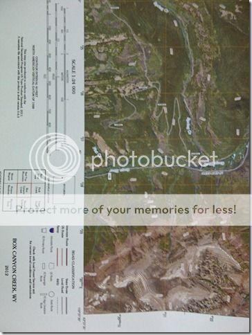
Herman-20120912-004131.jpg
 
I got in the mail today my new USGS topo map. I used to carry topo maps with me all the time but now with the GPS and google earth you don't need as much. But I did do some research on maps and found what appears a "new"?? map. It is labeled for 2012 so it must be new for this area at least. It is a topo map with elevation/contour lines over top of satellite imagery map. Kinda neat so I had to get one. They are $15 instead of the usual $8. It also took a couple weeks. I called today and the receptionist said they don't print this one till friday or something. When I got off the phone Fedex walked in the shop and delivered it. 30 or 26

Herman-20120912-004131.jpg

Would you provide the link to where you ordered these?
 
The USGS Store - One stop shop for all your maps, world, United States, state, wall decor, historic, planetary, topographic, trail, hiking, foreign, satellite, digital

Find your location
then Mark your point
then click the marker to see the available maps
then click on the map you are interested in.

You can download them and look at them.

I hope this helps.

Thanks drbill. That is a new product to me and a great one! I'm thinking I should be able to download the map, email the .pdf to my local Office Max or other print shop and have them print one up and have it ready for me today. Perhaps they'll have double sides presentation paper of photo quality and print one map one one side and another map on the other side. No since in having one side of the paper be blank, eh? Thanks for finding this.
 
I use that site quite a bit. Use both the orthoquads and the regular. We have a large format printer in our office so I can print the whole map. If you only want parts you can also just print chunks of it on good ol 8.5 by 11 on your printer at home. It is a heck of a lot easier, and cheaper, than buying a bunch of maps.
 
I use that site quite a bit. Use both the orthoquads and the regular. We have a large format printer in our office so I can print the whole map. If you only want parts you can also just print chunks of it on good ol 8.5 by 11 on your printer at home. It is a heck of a lot easier, and cheaper, than buying a bunch of maps.

So, sounds like you can print selective portions of the .pdf file. I'll have to look into how to do that. Any tips? I've got Adobe Reader X.
 
If you have a full version of ADOBE you can just crop pieces and save them individually. I do it the long way around with reader x. I have the map in the reader, zoom into what I want then use the Snipping tool in Windws 7 (if you use Windows 7). Save the snip as a jpeg then just open it and print.
 
If you have a full version of ADOBE you can just crop pieces and save them individually. I do it the long way around with reader x. I have the map in the reader, zoom into what I want then use the Snipping tool in Windws 7 (if you use Windows 7). Save the snip as a jpeg then just open it and print.

I'm still typing this using on old XP loaded laptop! I'll have to catch up one of these days... :)
 
If your in XP do a couple web searches and you can get some free versions of Snagit, which is the same as the clipping tool in Windows 7. I believe Miicrosoft acutally bought snagit.
 
If your in XP do a couple web searches and you can get some free versions of Snagit, which is the same as the clipping tool in Windows 7. I believe Miicrosoft acutally bought snagit.

Will do. Thanks for the tip! I always take a printed off chunk the relevant portion of a 7.5 quad, but to have a ortho and topo in one would be great, although the quad portions I have been printing from an old TOPO program allow me to label the edges (and put a lat/long grid on the map) with lat/long so I can find my location on the printed map easier.
 
You can also get a tool bar for adobe acrobat called "TerraGo Toolbar that allows you to do some pretty neat stuff, turn on and off layers, measure, mark, view coordinates, etc. The new orthophotos are really cool...I just downloaded a bunch a few weeks ago. We have a HP printer that prints tabloid size (11x17) and I have been busy... I thought about printing out some big maps at the local print/post place, but it was way too expensive. 11x17 is plenty big for me. I usually print the USGS quad out on 11x17, then print out areas of interest on 8.5x11. Have fun. GIS is great for hunting!
 
Warning! This thread is more than 12 years ago old.
It's likely that no further discussion is required, in which case we recommend starting a new thread. If however you feel your response is required you can still do so.
Top