2 is 1 and 1 is none.Haha! I carry 2 compasses! Always need a spare in case you lose one, or two. Sound familiar?

2 is 1 and 1 is none.Haha! I carry 2 compasses! Always need a spare in case you lose one, or two. Sound familiar?
I have posted earlier on having the "Old School" Topo Maps and Compass. This is 2021 almost 2022. If I get the chance to hunt in another country or really out of the way population Areas I will definitely take a Personal Locator Beacon "PLB". I wrote a post a week or so about "PLB" and the importance of having one.
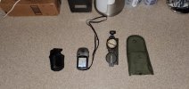
I will always carry a "Compass and Map" in areas where I am new to or not. You can get turned around
I do have to say the the all the new technology that is available to us-USE these systems. Not only can you see where you are at, but you can see where your partners as well. It is just a miracle of what is done with technology. DON'T discard it! Use it to you advantage. Sure there are instances where storms/environmental conditions my hinder the GPS, but far less than often. Sure keep a "BACKUP". These days this technology is AWESOME.
I had marked some of my Tree stands and also Buck Scrapes over (10) years ago on my Garmin "ETREX". Had dozens if not hundreds of "Way Points" Marked. I transferred these "Way Points" that I saved on my laptop to my newer Garmin GPS I went to the area last week and found my "Tree Stands" and also several "Scrapes" that were still active.
Keep the "Old School"
BUT EMBRACE NEW TECHNOLOGY!!!!!!!
It will only be to your advantage in hunting, scouting and for your SAFETY!
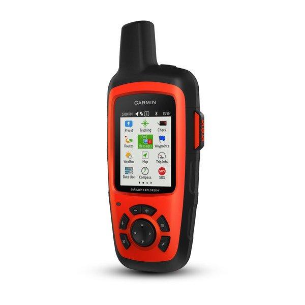
I use the Garmin inreach Explorer +. It's nice having the security blanket of the SOS function, but also being able to text people that I need a ride incase my truck breaks down deep in the bush which is more likely than a catastrophic medical emergency.I've been looking at the Garmen Etrex with a beacon. Good piece of kit for sure. I find myself using the OnX Hunt App quite a bit now days too. Worth the fee for many reasons.
I use the Garmin inreach Explorer +. It's nice having the security blanket of the SOS function, but also being able to text people that I need a ride incase my truck breaks down deep in the bush which is more likely than a catastrophic medical emergency.
 www.garmin.com
Have you looked into zoleo?Looks like Garmin is discontinuing the InReach line and is bundling those functions into some of their GPS units. That's sad, I don't need another GPS. I need a "come get me, I'm screwed" way of contacting my friends or if bad enough the local SAR.
Garmin inReach Explorer®+ | Satellite Communicator with TOPO Maps
inReach Explorer®+ is a satellite communicator featuring TOPO maps. This device is your go-to connection for off-the-grid contact.