Anything better than Mytopo?

ARTD338

Member
Joined
May 6, 2013
Messages
13
Location
NW Indiana
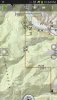
Was wondering for a purely hunting application does any map company produce hybrid topo/air photos superior to the ones sold by Mytopo? Need such hybrid map for long range scouting of public land I'm deer hunting this year.

Thanks,
Art.
 
I don't know of any. What I do is I have my Garmin gps and Topo 2008. I usually use Google Earth for satellite photos. The only problem is you have to rely on when the sat photo was taken. I like what I use because I can put way points of interesting looking places on the computer and download them to the gps. Then it is just a matter of following the gps to my way point. I also used my gps for tracks and way points in the field and transferred them to my computer. I can then print my own customized maps with all my info on them.
 
If you have a smart phone or tablet the topo us maps app is awesome. It has topo, google, terrain, google maps, google earth, and a bunch of others.

Scot E.
 
So how does that smart phone app work when you lose cell service 30 miles from your hunting spot? Do you have to connect or can you download the info and access it without service?
 
If you are talkinga bout the topo us maps app, the premium app has an option to download maps to your phone for off grid use.

Scot E.
 
So how does that smart phone app work when you lose cell service 30 miles from your hunting spot? Do you have to connect or can you download the info and access it without service?

You can cache your maps before you head to the field. And your phone has a built in GPS so you don't need cellular coverage to use your phone as a GPS.
 
Try Caltopo.com. You can view multiple map sources, and add various layers, such as public land boundaries, shaded relief, and active fires. Best of all, it's free!
You can also export these maps to PDF for printing.
And another feature is to transfer these maps to your Garmin. You are however limited by Garmins custom map size (around 100 tiles on most models). But, as others mentioned, in the field I prefer to use my smartphone with cached TOPO & Aerial maps.
caltopo.jpg
caltopo1.jpg
 
You can cache your maps before you head to the field. And your phone has a built in GPS so you don't need cellular coverage to use your phone as a GPS.


I am not familiar with the term cache maps to to your phone please explain.

I would like gpsmaps to have a download showing land boundaries and ownership for andriod based smartphones. the potential market is huge and applicable.

Also what is the source for topo us maps apps??? cost of premium????
How does this compare for data usage on a plan. I think I can download via wifi to install the program and possibly the maps area??? less data used on my plan.

thanks very helpful information
odavid
 
When you cache maps on your smartphone you download the map from a computer. Then you can pull up the map. For my gps I have topo2008 and can load any map into the gps for the lower 48 states. I select the area I will be hunting in but I also take my laptop and CD with me if I want to go somewhere I have not loaded the maps for. The gps does not have enough memory to hold what the cd has on it. Looking at Google Earth I put interesting points I want to check out into the gps and then I can go to them and see what they look like.

I guess you could do the same thing with a smart phone I don't know because I still have the old flip phone as work can be hard on phones.
 
I am not familiar with the term cache maps to to your phone please explain.

I would like gpsmaps to have a download showing land boundaries and ownership for andriod based smartphones. the potential market is huge and applicable.

Also what is the source for topo us maps apps??? cost of premium????
How does this compare for data usage on a plan. I think I can download via wifi to install the program and possibly the maps area??? less data used on my plan.

thanks very helpful information
odavid

For Android, in my opinion, the best app for this is Backcountry Navigator. You can download that same map formats as shown in my post above (there's probably close to a dozen map layers to chose from), plus you can download the public land boundaries (although this app doesn't show land owner names, which just creates clutter, imo). The cost of this app is $10 and I think the land boundary add-on was about the same.

Yes, you can download all this prior with Wifi, so no data is needed. I leave my phone in airplane mode to conserve the battery. Here's a screenshot from my phone.....
 

Attachments

  • Screenshot_2014-03-16-22-54-07.jpg
    Screenshot_2014-03-16-22-54-07.jpg
    157 KB · Views: 97
Warning! This thread is more than 11 years ago old.
It's likely that no further discussion is required, in which case we recommend starting a new thread. If however you feel your response is required you can still do so.

Recent Posts

Top